- 0 Shopping Cart

Lyme Regis Case Study of Coastal Management

A Coastal Management Scheme in the UK
Lyme Regis is a small coastal town on the south coast of England. It lies on the western edge of the Dorset Coast and forms part of the Jurassic Coast, a World Heritage Site famous for its fossils and coastal landforms. The town is a popular tourist destination in the summer.
What were the reasons for coastal management in Lyme Regis?
The coast at Lyme Regis experiences erosion . Much of the town has been constructed on unstable cliffs, which experience some of the highest erosion rates in Europe due to high energy waves from the southwest and its geology. The geology of Lyme Regis is a mixture of limestone, resistant to erosion, and clay, vulnerable to erosion. The clay lies on limestone, so as the clay erodes, the cliffs are vulnerable to landslides. Therefore, houses, roads and farmland are at risk of cliff landslides.
In addition, tourist numbers were down due to the lack of beaches caused by erosion.
What was the coastal management strategy at Lyme Regis?
The local government developed a plan to manage the coastline at Lyme Regis called the Lyme Regis Environmental Improvement Scheme. During the planning process, the local government consulted different interest groups, including residents, fishermen, and environmentalists, to reduce conflicts.
Several strategies have been used to protect Lyme Regis from coastal erosion . These are explored below.

Coastal management strategies used at Lyme Regis
The harbour is dredged annually to improve navigation, and the dredged sand is used to replenish the beach . This provides additional protection from coastal processes and supports the tourist industry.
1990 - 1995
Phase 1 involved the construction of a sea wall and promenade to the east of the mouth of the River Lim. An emergency cliff stabilisation project was completed during the winter of 2003-2004. It involved using large nails to hold the rocks together, as well as improving drainage and reprofiling the slope of the beach.
£22 million was spent on extensive improvements to the seafront, including:
- the construction of new seawalls and promenades;
- the creation of a wide sand and shingle beach designed to absorb wave energy; and
- the extension of rock armour to protect the harbour wall (The Cobb) and to the eastern end of the seafront to absorb wave energy and retain the new beach.
Not undertaken
Phase 3 of the project, a plan to prevent landslips and coastal erosion to the west of The Cobb, was cancelled as the costs outweighed the benefits.
Phase 4 involved the construction of defences to protect the coast to the east of the town. The £20 million project involved building a 390m sea wall in front of the existing wall. 480 homes were protected as cliffs were stabilised by nailing, piling and improving drainage.
Nails, up to 19 metres long, have been installed into the cliffs. Once installed, the nails were covered with a 60 to 120-year design life mesh.
What are the effects of coastal management at Lyme Regis?
Positive impacts
There has been a significant improvement in the attractiveness of the seafront and beach due to nourishment and the wide promenade. This has led to increased visitor numbers, and seafront businesses are thriving.
The new defences have withstood recent stormy winters.
The harbour is better protected, benefiting the fishing industry and boat owners.
Negative impacts
Conflicts have increased as visitor numbers have increased. For example, local people have experienced increased traffic congestion and litter due to increased tourism .
Some feel the new coastal defences have spoilt the natural coastal landscape .
The new defences may interfere with natural coastal processes affecting neighbouring stretches of coastline, causing conflicts elsewhere.
Stabilising cliffs that prevent landslides will reduce the number of fossils found in the area.
Check your understanding

Premium Resources
Please support internet geography.
If you've found the resources on this page useful please consider making a secure donation via PayPal to support the development of the site. The site is self-funded and your support is really appreciated.
Related Topics
Use the images below to explore related GeoTopics.
Topic Home
Next topic page, share this:.
- Click to share on Twitter (Opens in new window)
- Click to share on Facebook (Opens in new window)
- Click to share on Pinterest (Opens in new window)
- Click to email a link to a friend (Opens in new window)
- Click to share on WhatsApp (Opens in new window)
- Click to print (Opens in new window)
If you've found the resources on this site useful please consider making a secure donation via PayPal to support the development of the site. The site is self-funded and your support is really appreciated.
Search Internet Geography
Top posts and pages.
Latest Blog Entries
Pin It on Pinterest
- Click to share
- Print Friendly
Case Study, Coastal Management: Lyme Regis , Dorset , UK
Place specific info:
ü Lyme Regis is a small town on the South coast of the UK and makes up part of the stretch of coastline called the: Jurassic Coast. It is located in South West Dorset . ü It is an unspoilt seaside resort and fishing port on the historic harbour known as The Cobb. ü It is surrounded by beautiful coastlines, which are World Heritage Sites famous for fossils .
Opportunities at Lyme Regis
• Tourism is Dorset’s biggest industry. • This includes: recreational fishing, fossil hunting, boat trips, water sports like windsurfing , sailing and kayaking, beach trips, boat trips, village shops, fudge shops, museums, information centres for schools and families etc. • The tourism industry there is made up of a diverse range of small and medium sized businesses/enterprises (SME’s). • Meeting the demands of tourists is a challenge, which has to be balanced with the environment and community interests as well. • The local economy depends on tourism as a major source of income and jobs. • 37,500 people are employed directly and indirectly in the tourism sector in Dorset, with 65% of those working in a coastal area. This includes people who work in: restaurants, snack bars, night clubs, hotels, caravan parks, museums, art galleries, travel agencies, tour operators and sports and recreation providers. • The Dorset coast generates £800 million per year most of that comes from overnight stays, buying food and drink and entertainment and shopping. • There are both natural attractions and built attractions in the area. • Built attractions in Dorset include: Sea Life Park (Weymouth) 220,000 visits per year, Swanage Steam Railway 140,000 visits per year, Poole Pottery 1,000,000 visits per year, Bovington Tank Museum 121,535 visits per year. • Natural attractions include the unspoilt beaches so water cleanliness standards have to be high in order to keep attracting people to do sailing, windsurfing etc. • In Lyme Regis there are many events such as: April’s Fossil Festival, which showcases the Jurassic Coasts most famous rocks, May’s Jazz and Blues Festival, August’s Regatta, Summer closes with a carnival and Autumn opens with Guitars on the beach, in November effigies burn on a beach bonfire. • More fossils are released from the cliffs when there is a landslide so there is some benefit to tourism when the landslides. 500 to 1000 people arrived within hours of a landslip trying to find rare fossils locked in the hillside. Some were even swimming fully clothed. They thought they could make money from it.
Hazards of Lyme Regis:
v Rapid rates of coastal erosion and landslides e.g. the old road from Charmouth to Lyme Regis which ran across the top of the cliffs above the town v Landslides/landslips v Lyme Regis is built on a layer of limestone, which is very solid. On top of that layer are slippery muds, clays and sands, which slide over the limestone layer to form the landslides. These are all types of sedimentary rocks. v The sea erodes the cliffs at the bottom of the land, causing it to become unstable and slip even further. v The cliffs to the east of the town were prone to landslides especially after rain because the muds and clays were saturated with water. This area was popular with fossil hunters. v The beach was being eroded away. v The drainage system is inadequate to cope. v Houses, buildings and roads become damaged as the landslips towards the sea. v Black Venn is the largest and most active coastal landslide in Europe! v Nine of 60 Monmouth Beach chalets have been demolished since a landslip in January 2013. v In May 2008, about 1,300ft (400m) of cliff slipped between Lyme Regis and Charmouth, exposing an old landfill site (where rubbish is deposited)
Management of Lyme Regis: o The management plan has been divided into 4 zones and phases, East Cliff, Monmouth Beach, The Cobb and The Harbour to Cobb Gate. o More than £35 million has been spent since 1994 to prevent coastal erosion. o It was done to protect homes, roads and infrastructure from coastal erosion. o The work has secured 390 metres of coastline between Church Cliff and East Cliff for the next 50 years. 480 homes have been saved from damage or loss of access. o Major utility pipes and cables that would have otherwise been destroyed by ground movement are protected.
Problems: o Expensive for such a small community. o The protection will only last approximately 50 years. They might have to spend this amount of money again. There will be an expectation that they should continue to defend the region but the money could be spent elsewhere so they could just accept the fate of the town now, relocate everyone and redistribute money to other projects. o Sale of houses and businesses on the sea front after 50 years could be difficult.
Strategies: o Phase 1: Built a new sea wall and promenade with rock armour east of the mouth of the river Lim, finished in 1995. o Phase 2: Work started in 2005 ended in 2007 and cost £17 million. Protection to the sea front and stabilise the land immediately behind it, removal of old wooden groynes, replaced by big stone groynes. The beach was replenished with sand and shingle to absorb wave energy and protect the sea wall and sea front from erosion. Rock armour/rip rap added to the end of The Cobb harbour. Drainage improvements and weighing down of front of the cliff with soil nailing and steel piles in the park. o Phase 4: Started April 2013 and the area was officially open on 17th June 2015. Built a 390metre stretch of sea wall in the eastern part of Lyme Regis. Slopes at Church Cliff and East Cliff were stabilised. £19.5 million was spent on this phase, and it was deemed the ‘largest and most complex’ coastal protection schemes in England for years by the Environment Agency.
Benefits: • Long-term protection against destructive coastal erosion and landslips. • More sand and shingle on the beach. Better for tourism. • A new promenade along the seafront. It will be possible to walk along the whole beach even at high tide. Calmer conditions for boards in the harbour and bay. • Better access to the public gardens, including ramps for people using wheel chairs and prams. • Improvements to roads. A more secure future for the town’s people and businesses.
Types of 7 mark exam questions for this topic: Ø For a named area you have studied, describe and explain the opportunities of a coastline. Ø For a named area you have studied, describe the hazards of a coastline. Ø For a named area you have studied, describe and explain the management of hazards of a coastline.
Case Study: Lyme Regis
Coastal management in the uk - lyme regis, dorset.
Lyme Regis is a coastal town located on the south coast of England.

Coastal management
- Unstable cliffs and powerful waves lead to the fast erosion of the cliffs at Lyme Regis.
- Lyme Regis has a popular seafront which needs to be protected from damage.
- Previous coastal defences in Lyme Regis have NOT been successful.

Coastal defences in Lyme Regis
- The Lyme Regis Environmental Improvement Scheme aims to protect the coastline at Lyme Regis.
- The Lyme Regis Environmental Improvement Scheme was completed in 2015.
- The Lyme Regis Environmental Improvement Scheme cost £43 million.

Phases of the scheme
- Phases 1 and 2 involved new sea walls being built. Rock armour was also added to protect the beach.
- Phase 3 was cancelled following a cost-benefit analysis.
- Phase 4 involved new sea walls to provide extra protection. Work to make the cliffs more stable was also completed.
Impact of the Lyme Regis Environmental Improvement Scheme
The Lyme Regis Environmental Improvement Scheme has both a positive and negative impact on the local area.

Positive impact
- More tourists have visited Lyme Regis because the beaches have improved.
- More tourists have visited Lyme Regis because there is better protection for the harbour.
- Lyme Regis has been successfully protected from the sea during storms.

Negative impact
- People complain that the new defences ruin the natural coastline.
- People are worried the erosion will be worse in other areas because of changes to the process of long-shore drift.
1 Geography Skills
1.1 Mapping
1.1.1 Map Making
1.1.2 OS Maps
1.1.3 Grid References
1.1.4 Contour Lines
1.1.5 Symbols, Scale and Distance
1.1.6 Directions on Maps
1.1.7 Describing Routes
1.1.8 Map Projections
1.1.9 Aerial & Satellite Images
1.1.10 Using Maps to Make Decisions
1.2 Geographical Information Systems
1.2.1 Geographical Information Systems
1.2.2 How do Geographical Information Systems Work?
1.2.3 Using Geographical Information Systems
1.2.4 End of Topic Test - Geography Skills
2 Geology of the UK
2.1 The UK's Rocks
2.1.1 The UK's Main Rock Types
2.1.2 The UK's Landscape
2.1.3 Using Rocks
2.1.4 Weathering
2.2 Case Study: The Peak District
2.2.1 The Peak District
2.2.2 Limestone Landforms
2.2.3 Quarrying
3 Geography of the World
3.1 Geography of America & Europe
3.1.1 North America
3.1.2 South America
3.1.3 Europe
3.1.4 The European Union
3.1.5 The Continents
3.1.6 The Oceans
3.1.7 Longitude
3.1.8 Latitude
3.1.9 End of Topic Test - Geography of the World
4 Development
4.1 Development
4.1.1 Classifying Development
4.1.3 Evaluation of GDP
4.1.4 The Human Development Index
4.1.5 Population Structure
4.1.6 Developing Countries
4.1.7 Emerging Countries
4.1.8 Developed Countries
4.1.9 Comparing Development
4.2 Uneven Development
4.2.1 Consequences of Uneven Development
4.2.2 Physical Factors Affecting Development
4.2.3 Historic Factors Affecting Development
4.2.4 Human & Social Factors Affecting Development
4.2.5 Breaking Out of the Poverty Cycle
4.3 Case Study: Democratic Republic of Congo
4.3.1 The DRC: An Overview
4.3.2 Political & Social Factors Affecting Development
4.3.3 Environmental Factors Affecting the DRC
4.3.4 The DRC: Aid
4.3.5 The Pros & Cons of Aid in DRC
4.3.6 Top-Down vs Bottom-Up in DRC
4.3.7 The DRC: Comparison with the UK
4.3.8 The DRC: Against Malaria Foundation
4.4 Case Study: Nigeria
4.4.1 The Importance & Development of Nigeria
4.4.2 Nigeria's Relationships with the Rest of the World
4.4.3 Urban Growth in Lagos
4.4.4 Population Growth in Lagos
4.4.5 Factors influencing Nigeria's Growth
4.4.6 Nigeria: Comparison with the UK
5 Weather & Climate
5.1 Weather
5.1.1 Weather & Climate
5.1.2 Components of Weather
5.1.3 Temperature
5.1.4 Sunshine, Humidity & Air Pressure
5.1.5 Cloud Cover
5.1.6 Precipitation
5.1.7 Convectional Precipitation
5.1.8 Frontal Precipitation
5.1.9 Relief or Orographic Precipitation
5.1.10 Wind
5.1.11 Extreme Wind
5.1.12 Recording the Weather
5.1.13 Extreme Weather
5.2 Climate
5.2.1 Climate of the British Isles
5.2.2 Comparing Weather & Climate London
5.2.3 Climate of the Tropical Rainforest
5.2.4 End of Topic Test - Weather & Climate
5.3 Tropical Storms
5.3.1 Formation of Tropical Storms
5.3.2 Features of Tropical Storms
5.3.3 The Structure of Tropical Storms
5.3.4 Tropical Storms Case Study: Katrina Effects
5.3.5 Tropical Storms Case Study: Katrina Responses
6 The World of Work
6.1 Tourism
6.1.1 Landscapes
6.1.2 The Growth of Tourism
6.1.3 Benefits of Tourism
6.1.4 Economic Costs of Tourism
6.1.5 Social, Cultural & Environmental Costs of Tourism
6.1.6 Tourism Case Study: Blackpool
6.1.7 Ecotourism
6.1.8 Tourism Case Study: Kenya
7 Natural Resources
7.1.1 What are Rocks?
7.1.2 Types of Rock
7.1.4 The Rock Cycle - Weathering
7.1.5 The Rock Cycle - Erosion
7.1.6 What is Soil?
7.1.7 Soil Profiles
7.1.8 Water
7.1.9 Global Water Demand
7.2 Fossil Fuels
7.2.1 Introduction to Fossil Fuels
7.2.2 Fossil Fuels
7.2.3 The Global Energy Supply
7.2.5 What is Peak Oil?
7.2.6 End of Topic Test - Natural Resources
8.1 River Processes & Landforms
8.1.1 Overview of Rivers
8.1.2 The Bradshaw Model
8.1.3 Erosion
8.1.4 Sediment Transport
8.1.5 River Deposition
8.1.6 River Profiles: Long Profiles
8.1.7 River Profiles: Cross Profiles
8.1.8 Waterfalls & Gorges
8.1.9 Interlocking Spurs
8.1.10 Meanders
8.1.11 Floodplains
8.1.12 Levees
8.1.13 Case Study: River Tees
8.2 Rivers & Flooding
8.2.1 Flood Risk Factors
8.2.2 Flood Management: Hard Engineering
8.2.3 Flood Management: Soft Engineering
8.2.4 Flooding Case Study: Boscastle
8.2.5 Flooding Case Study: Consequences of Boscastle
8.2.6 Flooding Case Study: Responses to Boscastle
8.2.7 Flooding Case Study: Bangladesh
8.2.8 End of Topic Test - Rivers
8.2.9 Rivers Case Study: The Nile
8.2.10 Rivers Case Study: The Mississippi
9.1 Formation of Coastal Landforms
9.1.1 Weathering
9.1.2 Erosion
9.1.3 Headlands & Bays
9.1.4 Caves, Arches & Stacks
9.1.5 Wave-Cut Platforms & Cliffs
9.1.6 Waves
9.1.7 Longshore Drift
9.1.8 Coastal Deposition
9.1.9 Spits, Bars & Sand Dunes
9.2 Coast Management
9.2.1 Management Strategies for Coastal Erosion
9.2.2 Case Study: The Holderness Coast
9.2.3 Case Study: Lyme Regis
9.2.4 End of Topic Test - Coasts
10 Glaciers
10.1 Overview of Glaciers & How They Work
10.1.1 Distribution of Glaciers
10.1.2 Types of Glaciers
10.1.3 The Last Ice Age
10.1.4 Formation & Movement of Glaciers
10.1.5 Shaping of Landscapes by Glaciers
10.1.6 Glacial Landforms Created by Erosion
10.1.7 Glacial Till & Outwash Plain
10.1.8 Moraines
10.1.9 Drumlins & Erratics
10.1.10 End of Topic Tests - Glaciers
10.1.11 Tourism in Glacial Landscapes
10.1.12 Strategies for Coping with Tourists
10.1.13 Case Study - Lake District: Tourism
10.1.14 Case Study - Lake District: Management
11 Tectonics
11.1 Continental Drift & Plate Tectonics
11.1.1 The Theory of Plate Tectonics
11.1.2 The Structure of the Earth
11.1.3 Tectonic Plates
11.1.4 Plate Margins
11.2 Volcanoes
11.2.1 Volcanoes & Their Products
11.2.2 The Development of Volcanoes
11.2.3 Living Near Volcanoes
11.3 Earthquakes
11.3.1 Overview of Earthquakes
11.3.2 Consequences of Earthquakes
11.3.3 Case Study: Christchurch, New Zealand Earthquake
11.4 Tsunamis
11.4.1 Formation of Tsunamis
11.4.2 Case Study: Japan 2010 Tsunami
11.5 Managing the Risk of Volcanoes & Earthquakes
11.5.1 Coping With Earthquakes & Volcanoes
11.5.2 End of Topic Test - Tectonics
12 Climate Change
12.1 The Causes & Consequences of Climate Change
12.1.1 Evidence for Climate Change
12.1.2 Natural Causes of Climate Change
12.1.3 Human Causes of Climate Change
12.1.4 The Greenhouse Effect
12.1.5 Effects of Climate Change on the Environment
12.1.6 Effects of Climate Change on People
12.1.7 Climate Change Predictions
12.1.8 Uncertainty About Future Climate Change
12.1.9 Mitigating Against Climate Change
12.1.10 Adapting to Climate Change
12.1.11 Case Study: Bangladesh
13 Global Population & Inequality
13.1 Global Populations
13.1.1 World Population
13.1.2 Population Structure
13.1.3 Ageing Populations
13.1.4 Youthful Populations
13.1.5 Population Control
13.1.6 Mexico to USA Migration
13.1.7 End of Topic Test - Development & Population
14 Urbanisation
14.1 Urbanisation
14.1.1 Rural Characterisitcs
14.1.2 Urban Characteristics
14.1.3 Urbanisation Growth
14.1.4 The Land Use Model
14.1.5 Rural-Urban Pull Factors
14.1.6 Rural-Urban Push Factors
14.1.7 The Impacts of Migration
14.1.8 Challenges of Urban Areas in Developed Countries
14.1.9 Challenges of Urban Areas in Developing Countries
14.1.10 Urban Sustainability
14.1.11 Case Study: China's Urbanisation
14.1.12 Major UK Cities
14.1.13 Urbanisation in the UK
14.1.14 End of Topic Test- Urbanisation
14.1.15 End of Topic Test - Urban Issues
15 Ecosystems
15.1 The Major Biomes
15.1.1 Distribution of Major Biomes
15.1.2 What Affects the Distribution of Biomes?
15.1.3 Biome Features: Tropical Forests
15.1.4 Biome Features: Temperate Forests
15.1.5 Biome Features: Tundra
15.1.6 Biome Features: Deserts
15.1.7 Biome Features: Tropical Grasslands
15.1.8 Biome Features: Temperate Grasslands
15.2 Case Study: The Amazon Rainforest
15.2.1 Interdependence of Rainforest Ecosystems
15.2.2 Nutrient Cycling in Tropical Rainforests
15.2.3 Deforestation in the Amazon
15.2.4 Impacts of Deforestation in the Amazon
15.2.5 Protecting the Amazon
15.2.6 Adaptations of Plants to Rainforests
15.2.7 Adaptations of Animals to Rainforests
16 Life in an Emerging Country
16.1 Case Studies
16.1.1 Mumbai: Opportunities
16.1.2 Mumbai: Challenges
17 Analysis of Africa
17.1 Africa
17.1.1 Desert Biomes in Africa
17.1.2 The Semi-Desert Biome
17.1.3 The Savanna Biome
17.1.4 Overview of Tropical Rainforests
17.1.5 Colonisation History
17.1.6 Population Distribution in Africa
17.1.7 Economic Resources in Africa
17.1.8 Urbanisation in Africa
17.1.9 Africa's Location
17.1.10 Physical Geography of Africa
17.1.11 Desertification in Africa
17.1.12 Reducing the Risk of Desertification
17.1.13 Case Study: The Sahara Desert - Opportunities
17.1.14 Case Study: The Sahara Desert - Development
18 Analysis of India
18.1 India - Physical Geography
18.1.1 Geographical Location of India
18.1.2 Physical Geography of India
18.1.3 India's Climate
18.1.4 Natural Disasters in India
18.1.5 Case Study: The Thar Desert
18.1.6 Case Study: The Thar Desert - Challenges
18.2 India - Human Geography
18.2.1 Population Distribution in India
18.2.2 Urabinsation in India
18.2.3 The History of India
18.2.4 Economic Resources in India
19 Analysis of the Middle East
19.1 The Middle East
19.1.1 Physical Geography of the Middle East
19.1.2 Human Geography of the Middle East
19.1.3 Climate Zones in the Middle East
19.1.4 Climate Comparison with the UK
19.1.5 Oil & Natural Gas in the Middle East
19.1.6 Water in the Middle East
19.1.7 Population of the Middle East
19.1.8 Development Case Studies: The UAE
19.1.9 Development Case Studies: Yemen
19.1.10 Supporting Development in Yemen
19.1.11 Connection to the UK
19.1.12 Importance of Oil
19.1.13 Oil & Tourism in the UAE
20 Analysis of Bangladesh
20.1 Bangladesh Physical Geography
20.1.1 Location of Bangladesh
20.1.2 Climate of Bangladesh
20.1.3 Rivers in Bangladesh
20.1.4 Flooding in Bangladesh
20.2 Bangladesh Human Geography
20.2.1 Population Structure in Bangladesh
20.2.2 Urbanisation in Bangladesh
20.2.3 Bangladesh's Economy
20.2.4 Energy & Sustainability in Bangladesh
21 Analysis of Russia
21.1 Russia's Physical Geography
21.1.1 Russia's Climate
21.1.2 Russia's Landscape
21.2 Russia's Human Geography
21.2.1 Population of Russia
21.2.2 Russia's Economy
21.2.3 Energy & Sustainability in Russia
Jump to other topics

Unlock your full potential with GoStudent tutoring
Affordable 1:1 tutoring from the comfort of your home
Tutors are matched to your specific learning needs
30+ school subjects covered
Case Study: The Holderness Coast
End of Topic Test - Coasts

- 2023 Predicted Papers
- A-Level Biology
- A-Level Chemistry
- A-Level Maths
- A-Level Psychology
- GCSE Science
- GCSE Further Maths (Level 2, Level 3, FSMQ)
- GCSE History
- GCSE Citizenship
- GCSE Geography
- Group Code Registration Form
- Biology Reading List
- Chemistry Reading List
- The Ultimate guide to the EPQ
- UCAS and University
- How to help your child succeed in exams
- How to succeed in homeschooling
- Teacher Shop
- Group Registration
- Group Registration FAQs
- Your Profile
GCSE Geography – Case Study – Costal Management at Lyme Regis
Quiz summary.
0 of 10 Questions completed
Information
You have already completed the quiz before. Hence you can not start it again.
Quiz is loading…
You must sign in or sign up to start the quiz.
You must first complete the following:
Quiz complete. Results are being recorded.
0 of 10 Questions answered correctly
Time has elapsed
You have reached 0 of 0 point(s), ( 0 )
Earned Point(s): 0 of 0 , ( 0 ) 0 Essay(s) Pending (Possible Point(s): 0 )
- Not categorized 0%
1 . Question
Where is Lyme Regis?
- West Midlands.
2 . Question
On which coast is Lyme Regis?
3 . Question
Lyme Regis lies at the heart of a World Heritage site. What is this called?
- Jurassic Coast.
- Jurassic Park.
- Neolithic Coast.
- Alluvial coast.
4 . Question
What is the Lyme Regis area famous for?
- Fish and chips.
5 . Question
When was the Lyme Regis Environmental Improvement Scheme completed?
6 . Question
How many phases were originally planned for the Lyme Regis Environmental Improvement Scheme?
7 . Question
In the 1990’s, during the construction of the sea wall, what was used to the hold rocks together?
8 . Question
Why was phase three never undertaken?
- Cost outweighed benefits.
- Rainfall too heavy.
- Foundations were washed away.
- Labour shortage.
9 . Question
What type of hard engineering was used at The Cobb?
- Rock armour.
- Sand dunes.
10 . Question
What type of material was used for beach nourishment?
- Sand & shingle.
- Marram grass.
- Terms and Conditions
- Privacy Policy
Privacy Overview
Username or Email Address
Remember Me

Registration confirmation will be emailed to you.
- International
- Schools directory
- Resources Jobs Schools directory News Search

Coastal Management: Lyme Regis
Subject: Geography
Age range: 14-16
Resource type: Lesson (complete)
Last updated
21 January 2023
- Share through email
- Share through twitter
- Share through linkedin
- Share through facebook
- Share through pinterest
AQA GCSE Geography lesson for the new specification Unit 1C: In this lesson we look at how coastal management has been undertaken at Lyme Regis in Dorset.
The lesson has a retrieval practice starter based around a field sketch of a coastline. We firstly introduce Lyme Regis as an example of coastal management and consider which interest groups may have concerns about the construction of new sea defences. The pupils complete a worksheet where they read through the four phases of coastal management, highlight examples of hard and soft engineering and answer some questions. They then complete a map skills activity where they label on where the coastal defences have been built using 6-figure grid references. We then look at the positive and negatives of coastal management in Lyme Regis. We finish with a GCSE-style practice question with some guidance and structure provided for the students.
Hope this saves you some valuable planning time.
https://www.tes.com/teaching-resources/shop/markthegeographer
Tes paid licence How can I reuse this?
Your rating is required to reflect your happiness.
It's good to leave some feedback.
Something went wrong, please try again later.
This resource hasn't been reviewed yet
To ensure quality for our reviews, only customers who have purchased this resource can review it
Report this resource to let us know if it violates our terms and conditions. Our customer service team will review your report and will be in touch.
Not quite what you were looking for? Search by keyword to find the right resource:
- Yekaterinburg
- Novosibirsk
- Vladivostok

- Tours to Russia
- Practicalities
- Russia in Lists
Rusmania • Deep into Russia
Out of the Centre
Savvino-storozhevsky monastery and museum.

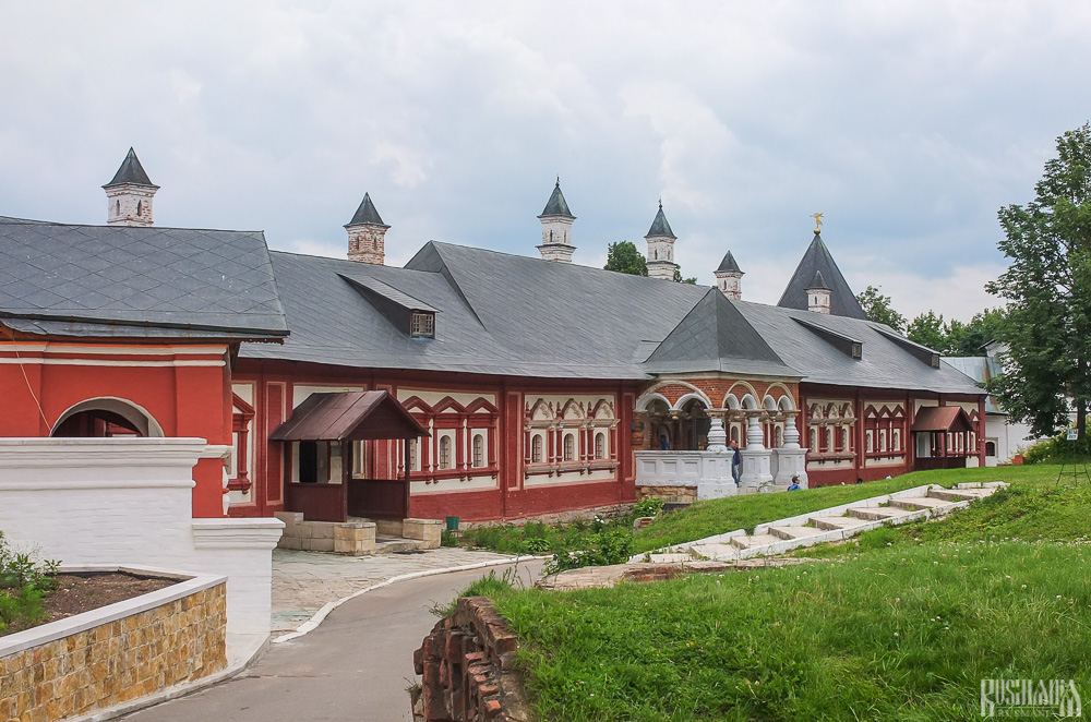
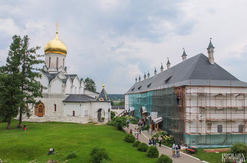
Zvenigorod's most famous sight is the Savvino-Storozhevsky Monastery, which was founded in 1398 by the monk Savva from the Troitse-Sergieva Lavra, at the invitation and with the support of Prince Yury Dmitrievich of Zvenigorod. Savva was later canonised as St Sabbas (Savva) of Storozhev. The monastery late flourished under the reign of Tsar Alexis, who chose the monastery as his family church and often went on pilgrimage there and made lots of donations to it. Most of the monastery’s buildings date from this time. The monastery is heavily fortified with thick walls and six towers, the most impressive of which is the Krasny Tower which also serves as the eastern entrance. The monastery was closed in 1918 and only reopened in 1995. In 1998 Patriarch Alexius II took part in a service to return the relics of St Sabbas to the monastery. Today the monastery has the status of a stauropegic monastery, which is second in status to a lavra. In addition to being a working monastery, it also holds the Zvenigorod Historical, Architectural and Art Museum.
Belfry and Neighbouring Churches
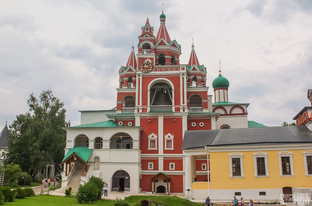
Located near the main entrance is the monastery's belfry which is perhaps the calling card of the monastery due to its uniqueness. It was built in the 1650s and the St Sergius of Radonezh’s Church was opened on the middle tier in the mid-17th century, although it was originally dedicated to the Trinity. The belfry's 35-tonne Great Bladgovestny Bell fell in 1941 and was only restored and returned in 2003. Attached to the belfry is a large refectory and the Transfiguration Church, both of which were built on the orders of Tsar Alexis in the 1650s.
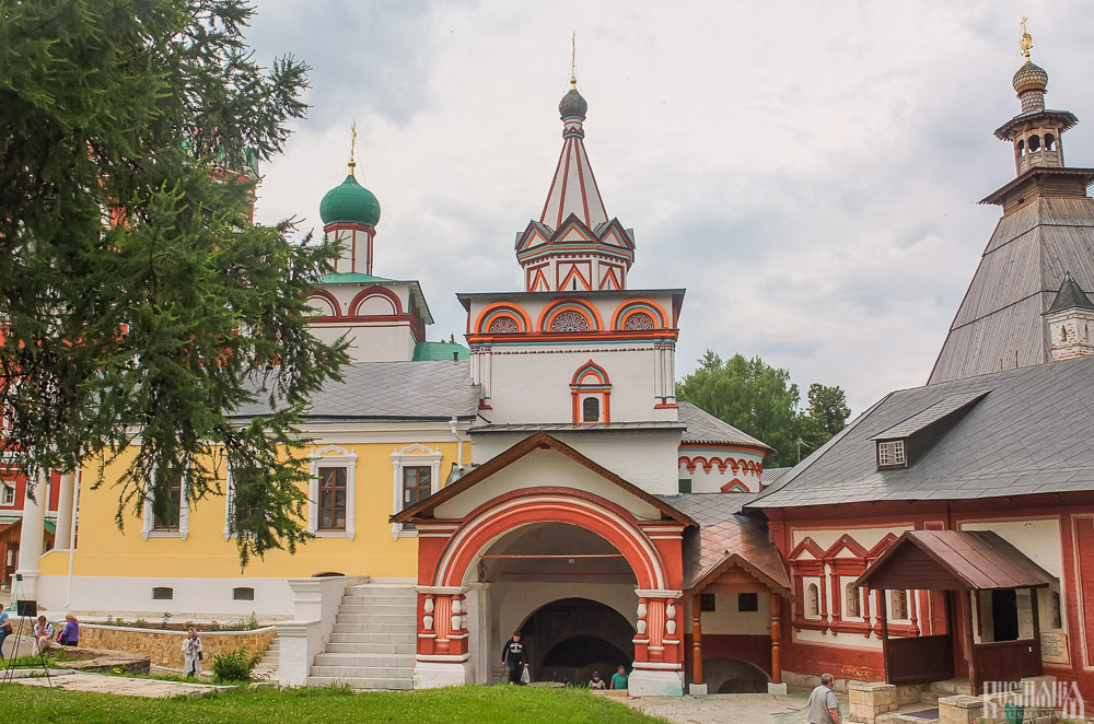
To the left of the belfry is another, smaller, refectory which is attached to the Trinity Gate-Church, which was also constructed in the 1650s on the orders of Tsar Alexis who made it his own family church. The church is elaborately decorated with colourful trims and underneath the archway is a beautiful 19th century fresco.
Nativity of Virgin Mary Cathedral
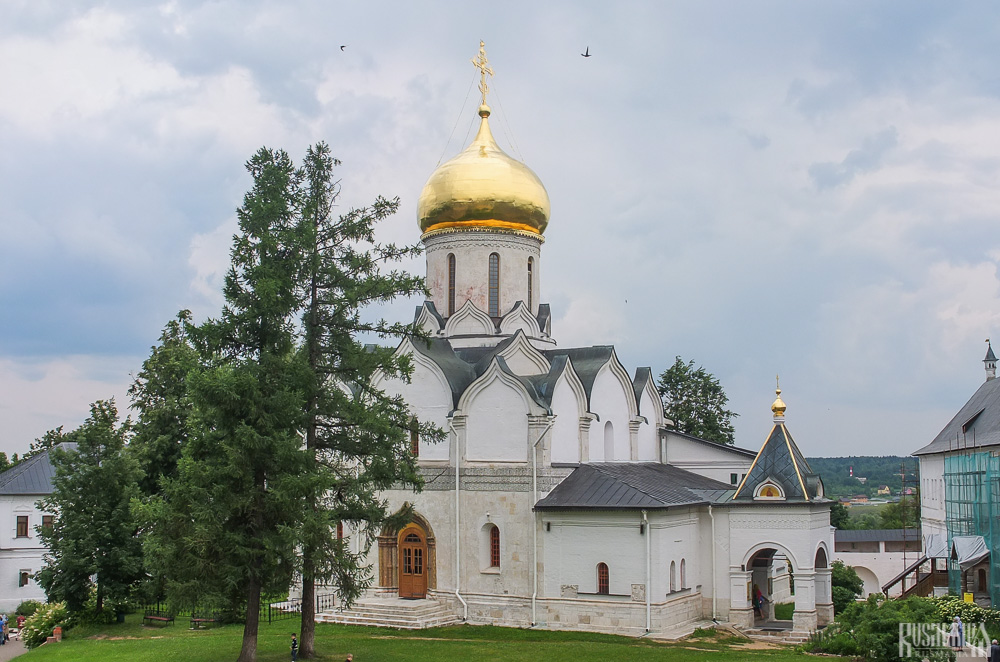
The Nativity of Virgin Mary Cathedral is the oldest building in the monastery and among the oldest buildings in the Moscow Region. It was built between 1404 and 1405 during the lifetime of St Sabbas and using the funds of Prince Yury of Zvenigorod. The white-stone cathedral is a standard four-pillar design with a single golden dome. After the death of St Sabbas he was interred in the cathedral and a new altar dedicated to him was added.
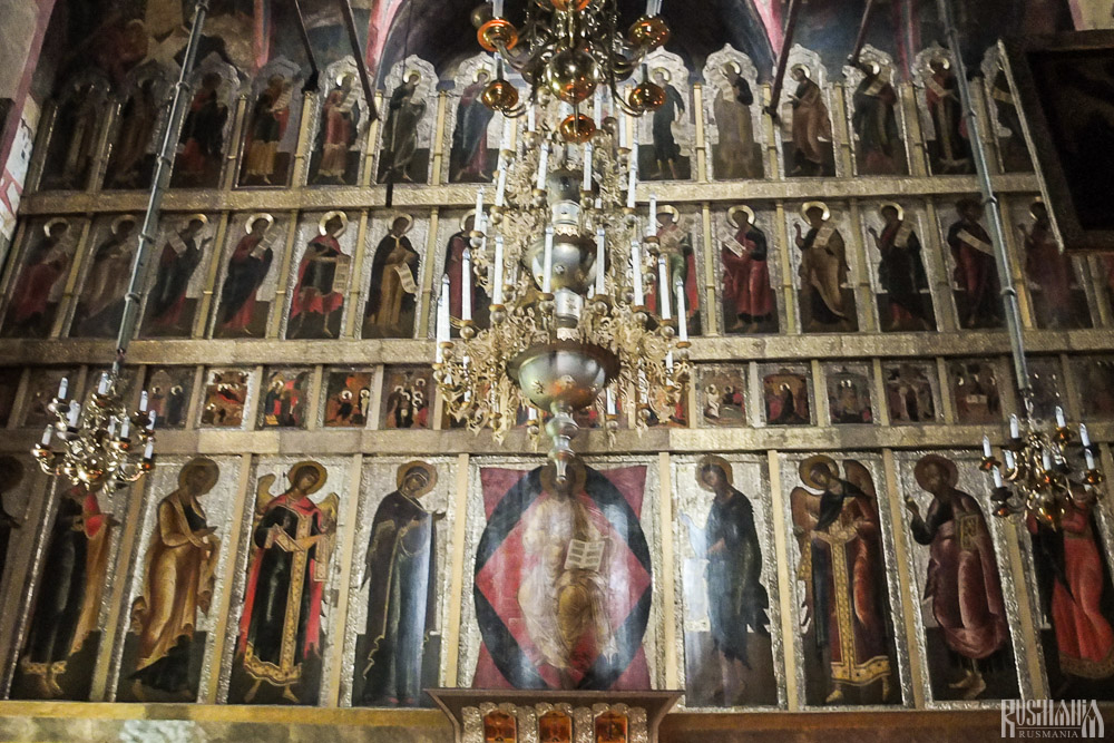
Under the reign of Tsar Alexis the cathedral was decorated with frescoes by Stepan Ryazanets, some of which remain today. Tsar Alexis also presented the cathedral with a five-tier iconostasis, the top row of icons have been preserved.
Tsaritsa's Chambers
The Nativity of Virgin Mary Cathedral is located between the Tsaritsa's Chambers of the left and the Palace of Tsar Alexis on the right. The Tsaritsa's Chambers were built in the mid-17th century for the wife of Tsar Alexey - Tsaritsa Maria Ilinichna Miloskavskaya. The design of the building is influenced by the ancient Russian architectural style. Is prettier than the Tsar's chambers opposite, being red in colour with elaborately decorated window frames and entrance.
At present the Tsaritsa's Chambers houses the Zvenigorod Historical, Architectural and Art Museum. Among its displays is an accurate recreation of the interior of a noble lady's chambers including furniture, decorations and a decorated tiled oven, and an exhibition on the history of Zvenigorod and the monastery.
Palace of Tsar Alexis
The Palace of Tsar Alexis was built in the 1650s and is now one of the best surviving examples of non-religious architecture of that era. It was built especially for Tsar Alexis who often visited the monastery on religious pilgrimages. Its most striking feature is its pretty row of nine chimney spouts which resemble towers.
Plan your next trip to Russia
Ready-to-book tours.
Your holiday in Russia starts here. Choose and book your tour to Russia.
The Unique Burial of a Child of Early Scythian Time at the Cemetery of Saryg-Bulun (Tuva)
<< Previous page
Pages: 379-406
In 1988, the Tuvan Archaeological Expedition (led by M. E. Kilunovskaya and V. A. Semenov) discovered a unique burial of the early Iron Age at Saryg-Bulun in Central Tuva. There are two burial mounds of the Aldy-Bel culture dated by 7th century BC. Within the barrows, which adjoined one another, forming a figure-of-eight, there were discovered 7 burials, from which a representative collection of artifacts was recovered. Burial 5 was the most unique, it was found in a coffin made of a larch trunk, with a tightly closed lid. Due to the preservative properties of larch and lack of air access, the coffin contained a well-preserved mummy of a child with an accompanying set of grave goods. The interred individual retained the skin on his face and had a leather headdress painted with red pigment and a coat, sewn from jerboa fur. The coat was belted with a leather belt with bronze ornaments and buckles. Besides that, a leather quiver with arrows with the shafts decorated with painted ornaments, fully preserved battle pick and a bow were buried in the coffin. Unexpectedly, the full-genomic analysis, showed that the individual was female. This fact opens a new aspect in the study of the social history of the Scythian society and perhaps brings us back to the myth of the Amazons, discussed by Herodotus. Of course, this discovery is unique in its preservation for the Scythian culture of Tuva and requires careful study and conservation.
Keywords: Tuva, Early Iron Age, early Scythian period, Aldy-Bel culture, barrow, burial in the coffin, mummy, full genome sequencing, aDNA
Information about authors: Marina Kilunovskaya (Saint Petersburg, Russian Federation). Candidate of Historical Sciences. Institute for the History of Material Culture of the Russian Academy of Sciences. Dvortsovaya Emb., 18, Saint Petersburg, 191186, Russian Federation E-mail: [email protected] Vladimir Semenov (Saint Petersburg, Russian Federation). Candidate of Historical Sciences. Institute for the History of Material Culture of the Russian Academy of Sciences. Dvortsovaya Emb., 18, Saint Petersburg, 191186, Russian Federation E-mail: [email protected] Varvara Busova (Moscow, Russian Federation). (Saint Petersburg, Russian Federation). Institute for the History of Material Culture of the Russian Academy of Sciences. Dvortsovaya Emb., 18, Saint Petersburg, 191186, Russian Federation E-mail: [email protected] Kharis Mustafin (Moscow, Russian Federation). Candidate of Technical Sciences. Moscow Institute of Physics and Technology. Institutsky Lane, 9, Dolgoprudny, 141701, Moscow Oblast, Russian Federation E-mail: [email protected] Irina Alborova (Moscow, Russian Federation). Candidate of Biological Sciences. Moscow Institute of Physics and Technology. Institutsky Lane, 9, Dolgoprudny, 141701, Moscow Oblast, Russian Federation E-mail: [email protected] Alina Matzvai (Moscow, Russian Federation). Moscow Institute of Physics and Technology. Institutsky Lane, 9, Dolgoprudny, 141701, Moscow Oblast, Russian Federation E-mail: [email protected]
Shopping Cart Items: 0 Cart Total: 0,00 € place your order
Price pdf version
student - 2,75 € individual - 3,00 € institutional - 7,00 €

Copyright В© 1999-2022. Stratum Publishing House
Academia.edu no longer supports Internet Explorer.
To browse Academia.edu and the wider internet faster and more securely, please take a few seconds to upgrade your browser .
Enter the email address you signed up with and we'll email you a reset link.
- We're Hiring!
- Help Center

Specific features of the ecological functioning of urban soils in Moscow and Moscow region

Eurasian Soil Science
Urban soils (constructozems) were studied in Moscow and several cities (Dubna, Pushchino, and Serebryanye Prudy) of Moscow oblast. The soil sampling from the upper 10-cm-thick layer was performed in the industrial, residential, and recreational functional zones of these cities. The biological (the carbon of the microbial biomass carbon, Cmic and the microbial (basal) respiration, BR) and chemical (pHwater and the contents of Corg, heavy metals, and NPK) indices were determined in the samples. The ratios of BR to Cmic (the microbial respiration quotient, qCO2) and of Cmic to Corg were calculated. The Cmic varied from 120 to 738 μg C/g soil; the BR, from 0.39 to 1.94 μg CO2-C/g soil per hour; the Corg, from 2.52 to 5.67%; the qCO2, from 1.24 to 5.28 μg CO2-C/mg Cmic/g soil per h; and the Cmic/Corg, from 0.40 to 1.55%. Reliable positive correlations were found between the Cmic and BR, the Cmic and Cmic/Corg, and the Cmic and Corg values (r = 0.75, 0.95, and 0.61, respectively), as well...
Related Papers
N.D. Ananyeva
Journal of Mining Institute
Alexey Alekseenko
Soils and plants of Saint Petersburg are under the constant technogenic stress caused by human activity in in-dustrial, residential, and recreational landscapes of the city. To assess the transformed landscapes of various functional zones, we studied utility, housing, and park districts with a total area of over 7,000 hectares in the southern part of the city during the summer seasons of 2016-2018. Throughout the fieldwork period, 796 individual pairs of soil and plant samples were collected. A complex of consequent laboratory studies performed in an accredited laboratory allowed the characterization of key biogeochemical patterns of urban regolith specimens and herbage samples of various grasses. Chemical analyses provided information on the concentrations of polluting metals in soils and plants of different land use zones. Data interpretation and calculation of element accumulation factors revealed areas with the most unfavorable environmental conditions. We believe that a high pollution level in southern city districts has led to a significant degree of physical, chemical, and biological degradation of the soil and vegetation cover. As of today, approximately 10 % of the Technosols in the study area have completely lost the ability to biological self-revitalization, which results in ecosystem malfunction and the urgent need for land remediation.
András Bidló
The main purpose of the present study was to monitor actual contamination levels and execute a comparative assessment of results in a mid-sized Hungarian city for two different years. The first citywide soil investigations were completed in 2011. In 2018, the most prominent properties (pH, CaCO3, texture, and trace metals Cd, Co, Cu, Ni, Pb, and Zn) were reanalyzed and were supplemented with mesofauna on selected sites. The available trace metal elements of urban soils showed the following tendency in 2011: Zn > Cu > Pb > Cd > Cr = Ni = Co. In 2018, the previous order changed to Zn > Pb > Cu > Cr > Cd = Ni = Co. Cd and Pb enrichments were found, especially near the M7 motorway. The comparison between 2011 and 2018 revealed soil contamination was, on average, higher in 2011. Soil microarthropod communities were sampled and assessed using abundance data and diversity measurements. Soil biological quality was evaluated with the help of the Soil Biological Qualit...
Mikhail Reshetnikov , Ngun Clement
A soil diagnosis of an urban territory Stepnoe (Saratov region) was conducted within the framework of soil research monitoring of inhabited localities with low levels of anthropogenic impact using chemical and microbiological analysis. Excess over maximum permissible concentration (MPC) of mobile forms of Cr, Zn and Cd were not observed within the researched territory. A universal excess over MPC of mobile forms of Ni, Cu and Pb was established which is most likely connected with anthropogenic contamination. It was discovered that, at the territory of the Stepnoe settlement, mobile forms of heavy metals compounds (HM) in most cases formed paragenetic associations with high correlation coefficient and despite this, an excess over MPC was not significant. This point to a common mineralogical origin of the elements inherited from the parent rock. The values of the total index of chemical contamination were not above 16, which puts the researched samples in a category with permissible contamination. The indices of the total number of heterotrophic bacteria, iron-oxidizing and hydrocarbon-oxidizing bacteria in most samples corresponded to normal indices for chestnut solonetsous and saline soils. In some samples, a deviation from the normal indices was observed justifying the impact of specific contaminants on the soil.
Soil Science Annual
Lidia Oktaba
The objective of the study was to determine properties of soils located within a city, and to assess the effect of anthropopressure on the accumulation of carbon and nitrogen in soils of Pruszków . a medium sized town in central Poland. Surface soil layers (0.20 cm) were collected at 36 sites. A total of 12 samples from lawns, 11 from allotment gardens, 9 from fields and 4 from fallow lands were subject to analysis. Lawns and allotment gardens were treated as central zone I . under strong pressure of anthropogenic factors, fields and fallow lands were treated as zone II . with potentially low level of anthropogenic influence. The statistical analysis showed significantly higher (p=0.008) amount of organic carbon (Corg) in lawns (mean 20.5 g·kg
For the first time, the quantitative geochemical data are given for urban soils of several groups of cities which differ in population. The content of chemical elements is considered as well as the specific ecological significance of soil contamination by these elements. The figures were established by authors on the base of average concentrations of chemical elements in the soils of more than 300 cities and settlements. The major part of data (sampling, analyses, and their statistical treatment) was obtained directly by authors as a result of special studies conducted for more than 15 years. The sufficiently numerous published materials of different researchers were also used. The greatest elements accumulation comparing with the Earth’s soils (tens of thousands of tons per 1 km2) is associated with an increase in the content of Ca and Mg. Considering the environmental significance of chemical elements accumulation in soils, we note the primary role of Pb and Zn in all groups of cities. Out from the rest pollutants it is necessary, first of all, to note As, Cu, and Cl, which are the main contaminants in four of six cities groups. In two groups of settlements, Cd and Co are important soil pollutants. In three groups, a considerable increase in the Ca content significantly modifies ecological–geochemical state of soils.
Richard Pouyat
Journal of Central European Agriculture
Marcos Francos
Soil Science
Heikki Setälä
RELATED PAPERS
ARS MEDICA Revista de Ciencias Médicas
Juan Manuel Muñoz Cano
Karl-Heinz Eggensperger
nguyễn Chí trung
Biochemical and Biophysical Research Communications
Lucy Waskell
Rahimah Zakaria
Physical Review B
YUTA SASAKI
Jeffrey Fisher
Patrícia Soares
Psicologia: Teoria e Pesquisa
rafaela barbosa
Journal of Thermal Analysis and Calorimetry
Smita Nagouda
BMC Public Health
Mohamed Eldigire
Dermatologia Cosmetica Medica Y Quirurgica
Roberto Arenas
Choy Heng Lai
Korean Journal of Environmental Agriculture
Chang Ki Shim
ReMark - Revista Brasileira de Marketing
Juliana Maria Magalhães Christino
Recherche et Applications en Marketing
Florence Jeannot
e-kutuphane.imo.org.tr
Osman Nuri ÇELİK
محمد إبراهيم
Journal of the Japan Petroleum Institute
Abdulla Saad
Journal of Biological Research - Bollettino della Società Italiana di Biologia Sperimentale
Alla Shevtsova
The Lancet Regional Health - Americas
Camilo Fernandes
Sociologija. Mintis ir veiksmas
Zenonas Norkus
Journal of Geography and Regional Planning
Charles Omondi
Journal of Marital and Family Therapy
Yuzunci Yil Universitesi Egitim Fakultesi Dergisi
AV.İSMAİL ÇEVİK
RELATED TOPICS
- We're Hiring!
- Help Center
- Find new research papers in:
- Health Sciences
- Earth Sciences
- Cognitive Science
- Mathematics
- Computer Science
- Academia ©2024
IMAGES
VIDEO
COMMENTS
Lyme Regis Case Study of Coastal Management. Lyme Regis is a small coastal town on the south coast of England. It lies on the western edge of the Dorset Coast and forms part of the Jurassic Coast, a World Heritage Site famous for its fossils and coastal landforms. The town is a popular tourist destination in the summer.
Coastal management. The coast of Lyme Regis is managed because: Unstable cliffs and powerful waves lead to the fast erosion of the cliffs at Lyme Regis. Lyme Regis has a popular seafront which needs to be protected from damage. Previous coastal defences in Lyme Regis have NOT been successful.
Case Study 8 Lyme Regis Environmental Improvements - FD2635.doc 2 Figure 1. Completed seawall, beach and jetties. Image courtesy of the Environment Agency 1 Case Study: Lyme Regis Environmental Improvements 1.1 Introduction 1.1.1 Description Lyme Regis is a coastal town in West Dorset situated 25 miles west of
Coastal Management 2019. Refurbishment and repair of the world-famous Cobb Harbour and breakwater in Lyme Regis - A case study describing the multiple social, economic and community benefits a coastal engineering project can bring, and the challenges this presents
Coastal Case Study - The Dorset Coast. The geology of the Dorset coast is perfect for both erosional and depositional landforms. It has bands of sedimentary rock, consisting of soft clay and harder limestone and chalk. These rocks erode at different rates creating headlands, bays, arches, a long tombolo and more.
Case Study, Coastal Management: Lyme Regis, Dorset, UK Place specific info: ü Lyme Regis is a small town on the South coast of the UK and makes up part of the stretch of coastline called the: Jurassic Coast. It is located in South West Dorset. ü It is an unspoilt seaside resort and fishing port on the historic harbour known as The Cobb. ü It is surrounded by beautiful coastlines, which are ...
The Lyme Regis Environmental Improvement Scheme had four phases: Phases 1 and 2 involved new sea walls being built. Rock armour was also added to protect the beach. Phase 3 was cancelled following a cost-benefit analysis. Phase 4 involved new sea walls to provide extra protection. Work to make the cliffs more stable was also completed.
In May 2008 a coastal landslide deposited landfill debris onto the shore near Lyme Regis, UK. Six months later, intertidal sediments and biota from the area were sampled to determine whether the ...
Request PDF | Coastal landfill and shoreline management: Implications for coastal adaptation infrastructure. Case Study: Lyme Regis | This report was produced by the University of Southampton ...
2.1 Study Area: Lyme Regis The geographic location of the study area in Lyme Regis is shown in Figure 1. Lyme Regis is an important coastal town 1with a population of 3,671 (2011 census). The town is located in Lyme Bay on the English Channel coast, in the west of the county of Dorset at the DorsetDevon border in -
Case Study, Coastal Management: Lyme Regis, Dorset, UK. Place specific info: ü Lyme Regis is a small town on the South coast of the UK and makes up part of the stretch of coastline called the: Jurassic Coast. It is located in South West Dorset. ü It is an unspoilt seaside resort and fishing port on the historic harbour known as The Cobb. ü ...
Learn about the causes, impacts and attempts of coastal erosion and management at Lyme Regis, a popular tourist destination in Dorset, southern England. Find out where Lyme Regis is located, how beach replenishment, groynes, sea wall and cliff stabilization can help protect the coastline and the local community.
A GCSE-level examination of how human activity can influence geomorphic processes along a stretch of coastline.
Reasons for coastal management in Lyme Regis - Experiences erosion. - Much of the town has been constructed on unstable cliffs which experience some of the highest erosion rates in Europe due to high energy waves from the southwest and its geology.
case-study-lyme-regis - Free download as PDF File (.pdf), Text File (.txt) or read online for free.
-new defences have withstood recent stormy winters-the harbour has been protected which benefits the fishing industry-improved the attraction which has increased visitor numbers and trade by 20%-people feel more secure buying property in Lyme Regis as they've been easier to insure against coastal erosion and landslides
GCSE Geography - Case Study - Costal Management at Lyme Regis . GCSE Geography - Case Study - Coastal Management at Medmerry . GCSE Geography - River erosion processes, transportation & deposition. GCSE Geography - River landscapes in the UK - The long and cross profiles of a river.
We firstly introduce Lyme Regis as an example of coastal management and consider which interest groups may have concerns about the construction of new sea defences. The pupils complete a worksheet where they read through the four phases of coastal management, highlight examples of hard and soft engineering and answer some questions.
Lyme Regis is a town found along the Jurassic Coastline - a World Heritage site and famous coast in England, known for its fossils and coastal landforms. This makes the area extremely popular with tourists , but with added risks to the coastline. Source: wdlh.co.uk. Threats to Lyme Regis. The coast along Lyme Regis is prone to erosion .
Enter the email address you signed up with and we'll email you a reset link.
Zvenigorod's most famous sight is the Savvino-Storozhevsky Monastery, which was founded in 1398 by the monk Savva from the Troitse-Sergieva Lavra, at the invitation and with the support of Prince Yury Dmitrievich of Zvenigorod. Savva was later canonised as St Sabbas (Savva) of Storozhev. The monastery late flourished under the reign of Tsar ...
Burial 5 was the most unique, it was found in a coffin made of a larch trunk, with a tightly closed lid. Due to the preservative properties of larch and lack of air access, the coffin contained a well-preserved mummy of a child with an accompanying set of grave goods. The interred individual retained the skin on his face and had a leather ...
Urban soils (constructozems) were studied in Moscow and several cities (Dubna, Pushchino, and Serebryanye Prudy) of Moscow oblast. The soil sampling from the upper 10-cm-thick layer was performed in the industrial, residential, and recreational