- 0 Shopping Cart


The Holderness Coast
The Holderness Coast is Europe’s fastest eroding coastline.
The Holderness Coast Case Study
Looking for information on the landforms of erosion and deposition on the Holderness Coast? You can find it here .
What is the location of the Holderness Coast?
The Holderness Coast is located on the east coast of England. It extends 61km from Flamborough in the north to Spurn Point in the south.
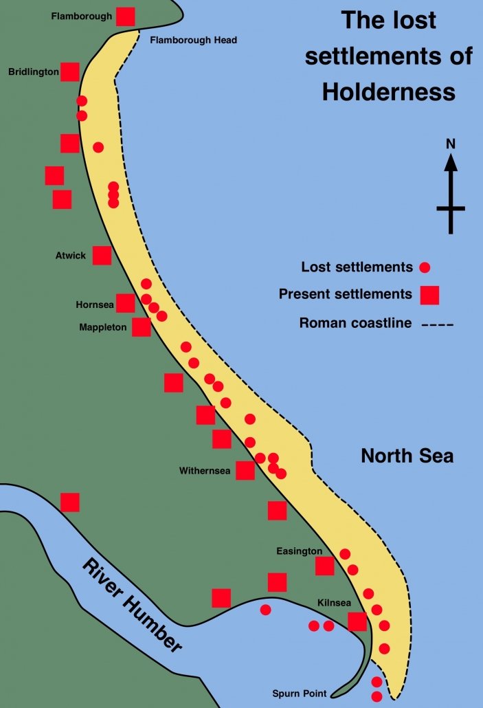
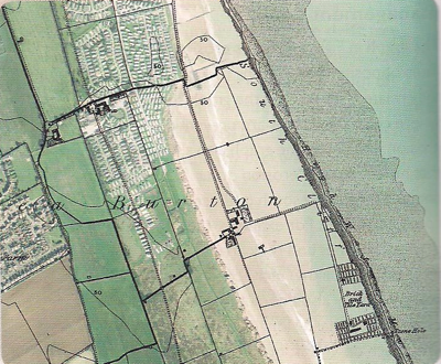
Lost settlements on the Holderness Coast
The Holderness Coastline is one of Europe’s fastest eroding at an average annual rate of around 2 metres. This is around 2 million tonnes of material every year. Approximately 3 miles (5kms) of land has been lost since Roman times, including 23 towns/villages. These are shown on the map below.
What is the geology of the Holderness Coast?
Underlying the Holderness Coast is bedrock made up of Cretaceous Chalk. However, in most places, this is covered by glacial till deposited over 18,000 years ago. It is this soft boulder clay that is being rapidly eroded.
There are two main reasons why this area is eroding so rapidly. The first is the result of the strong prevailing winds creating destructive waves. The second is that the cliffs are made of soft boulder clay, which erodes rapidly when saturated.
Holderness Coast Case Study
The Holderness Coast is a great case study for examining coastal processes and their associated features. This is because the area contains ‘textbook’ examples of coastal erosion and deposition. The exposed chalk of Flamborough provides examples of erosion and features such as caves, arches and stacks. Coastal management at Hornsea and Withernsea are examples of hard engineering solutions to coastal erosion. Erosion at Skipsea illustrates the human impact of erosion in areas where coastlines are not being defended. Mappleton is an excellent case study of an attempt at coastal management, which has a negative impact further along the coast.
Spurn Point provides evidence of longshore drift on the Holderness Coast. It is an excellent example of a spit, a depositional landform . Around 3% of the material eroded from the Holderness Coast is deposited here annually.
Find out more about the landforms of coastal erosion and deposition on the Holderness Coast .

Premium Resources
Please support internet geography.
If you've found the resources on this page useful please consider making a secure donation via PayPal to support the development of the site. The site is self-funded and your support is really appreciated.
Related Topics
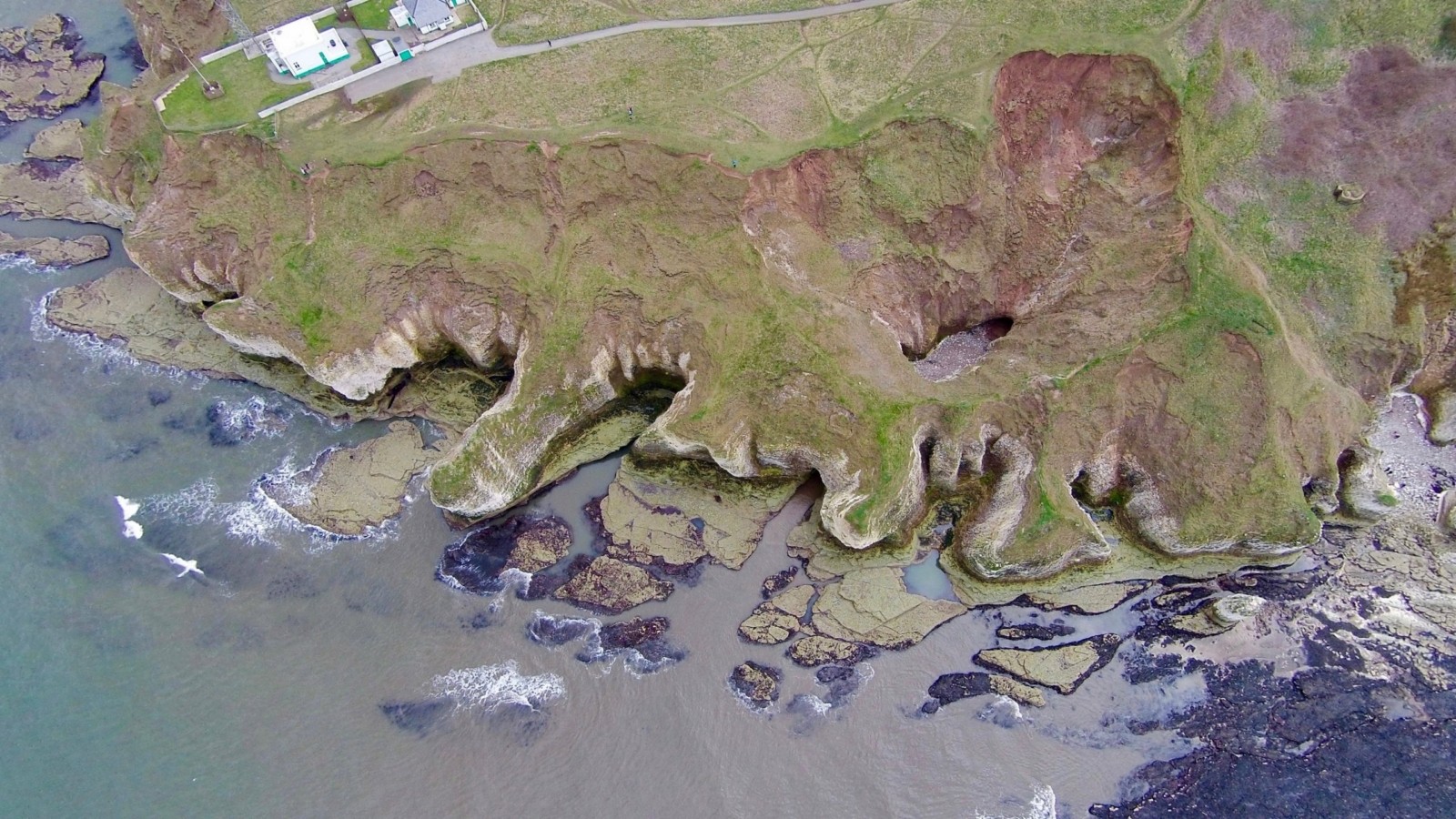
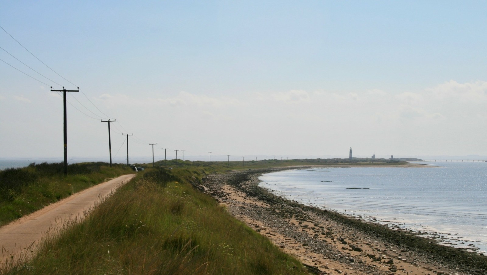
Use the images below to explore locations along the Holderness Coast.
Flamborough
Spurn Point
Share this:
- Click to share on Twitter (Opens in new window)
- Click to share on Facebook (Opens in new window)
- Click to share on Pinterest (Opens in new window)
- Click to email a link to a friend (Opens in new window)
- Click to share on WhatsApp (Opens in new window)
- Click to print (Opens in new window)
If you've found the resources on this site useful please consider making a secure donation via PayPal to support the development of the site. The site is self-funded and your support is really appreciated.
Search Internet Geography
Top posts and pages.
Latest Blog Entries
Pin It on Pinterest
- Click to share
- Print Friendly
The Holderness Coast is one of Europe’s fastest eroding coastlines. The average annual rate of erosion is around 2 metres per year. The main reason for this is because the bedrock is made up of till (soft clay). This material was deposited by glaciers around 12,000 years ago.
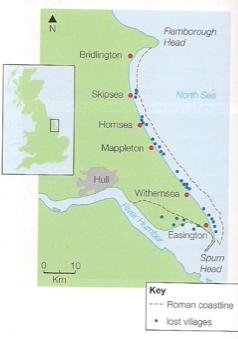
The coastline stretches along the coast of the East Riding of Yorkshire, known as Holderness, from Flamborough Head in the North, to Spurn Head in the south. Since Roman times, the Holderness Coast has retreated 4 km – at least 29 villages have been lost to the sea.
Why is erosion a problem?
Rates of erosion vary in places due to a mixture of human and physical factors. These can change in short and long term. There are three main reasons why Holderness is retreating:
• Geology (Figure 3)
• Longshore drift and beach material
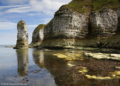
The Holderness Coastline is made up of soft boulder clays (tills) left after the retreat of the Devensian ice sheets about 12 000 years ago. They can be seen on the coast, being rapidly eroded by the sea. To look at, they are a mass of brown clay containing pieces of rock (erratics) brought here by the glaciers from Scandinavia, Scotland, the Lake District and Northeast England. These soft, recent deposits sit on a platform of chalk which slopes away gently to the east.
This is how far the waves have travelled. Holderness is exposed to wind and waves from the north-east, with a fetch of 500 to 800 km across the North Sea. This is not that far and would normally cause large waves but other factors increase their size:
• Currents (or swell) move northwards around the UK from the Atlantic and into the North Sea. The Atlantic’s fetch is 5000km so it’s currents add even more energy to the waves. This causes powerful destructive waves.
• Weather systems and winter storms in the North Sea are often intense. The low pressure raises the sea level, producing higher tides than normal and the storms add energy to the waves, especially in storms.
• The sea floor is deep in the North Sea, meaning waves hit the coast relatively fast and are not slowed down by friction.
Longshore Drift and Beach Material
• The beaches here are the main problem. Boulder clay erodes very easily and produces very small, fine clay particles, these are easily transported by longshore drift out to sea and along the coast, rather than accumulating in front of the cliffs, forming a layer of protection from the waves. The beaches are narrow and fail to absorb the wave energy, during high tide there is not enough beach and waves hit the base of the cliffs.
• Tides flow to the south, transporting material along the coast. There is an imbalance as the harder chalk up the coast does not provide enough material for places like Hornsea so backwash removes more than what is deposited by swash.
http://www.bbc.co.uk/education/clips/z8jfb9q

Why Manage?
ECONOMIC IMPACTS OF EROSION:
• Numbers of visitors to areas along of this coastline has dropped.
• Some settlements unable to maintain a viable population to warrant shops.
• Money has to be spent on coastal management and protection.
• The Gas Terminal in Easington, which supplies 25% of Britain’s gas, is at risk.
• 80000m2 of farmland is lost each year, this has a huge effect on farmer’s livelihoods.
• It’s predicted that 200 homes and several roads will fall into the sea by 2100 .
SOCIAL IMPACTS OF EROSION:
• Around 30 villages have been lost since Roman times, meaning homes and businesses have been lost.
• Many of the settlements rely heavily on tourism, as facilities close down the settlements are unable to maintain a good population.
• Properties under threat of erosion lose their value leaving owners with negative equity. There is no financial help to aid people as no compensation is paid out for the loss of private property or land caused by coastal erosion in England.
• The East Riding Coastal Fund has been set up to aid people.
ENVIRONMENTAL IMPACTS OF EROSION:
• Wildlife behind Spurn Point is losing diversity as the environment cannot support many species due to the lack of sediment. Spurn Head is a spit and salt marsh at the southern tip of the coastline.
• Some SSSIs (Sites Of Special Scientific Interest) are threatened by erosion.
Coastal Management
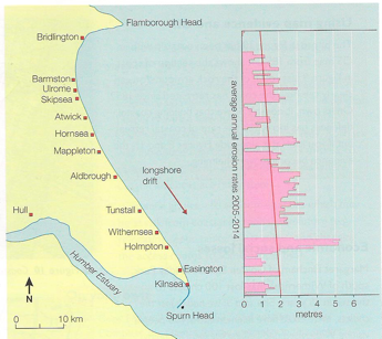
- The graph shows erosion rates opposite to their specific locations. Where there are gaps, it means coastal defences are present and working. You can see that there are higher rates of erosion directly south of these defences.
- This is due to the flow of beach material by longshore drift being stopped by protection methods such as groynes, sea walls and rock armour/rip rap.
- Hornsea may well be protected but places like Mappleton, directly south are starved of material are eroding at excessive rates, this is called terminal groynes syndrome.
Case Study: The Holderness Coast
Coastal erosion in holderness.
The Holderness coast is located next to the city of Hull in the north-east of England. Each year, the Holderness Coast retreats 1-2 metres. The area is particularly vulnerable to erosion because of:

Strong prevailing winds
- Strong prevailing winds create destructive waves that can do more damage to the coast.
- The prevailing winds also mean that any eroded material moves away from the place that was eroded (leaving the soft rock exposed).
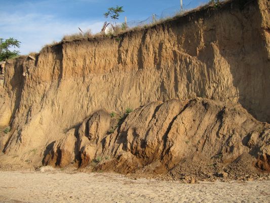
Clay cliffs
- The Holderness Coast is made of boulder clay.
- This is very soft and easy to erode.
- Heavy rainfall can cause mass movements in the boulder clay cliffs.
Coastal Management in Holderness
In 1991, a £2 million project built rock groynes and rock revetments at Mappleton in the Holderness coast. These are examples of hard engineering.
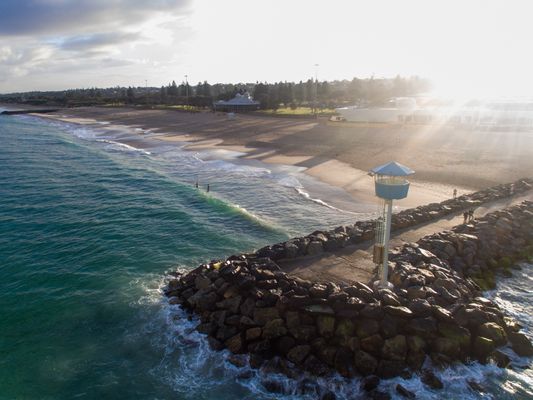
Rock groynes
- The rock groynes tried to stop sediment being carried away from the Holderness Coast and tried to create a larger beach to protect the land behind.
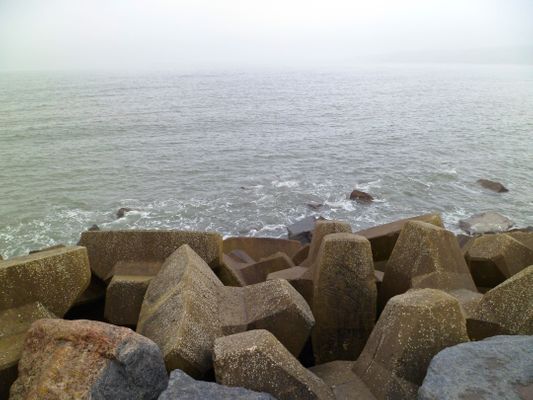
Rock armour
- Rock armour was placed at the foot of the cliffs.
- The rock armour is meant to absorb some of the waves' energy, instead of the coast or cliffs.
What are the Results & Effects of Coastal Management at Mappleton?
The cliffs at Mappleton now erode at 1-2 metres per year, instead of the 7-10 metres before 1991. Mappleton now has a larger beach, however, there have been some negative effects:
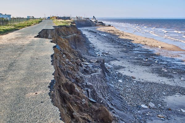
Area south of Mappleton
- The area south of Mappleton is experiencing faster coastal erosion as a byproduct.
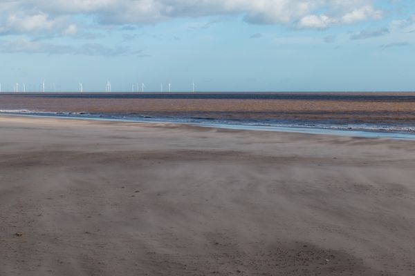
Spurn Point
- The Spurn Point area south, has become less secure.
- Less material is washed down the Holderness Coast.
- Some Hebridean Sheep were washed away and killed. People are now warned not to visit the Point at some times of year, or they too could be washed away.
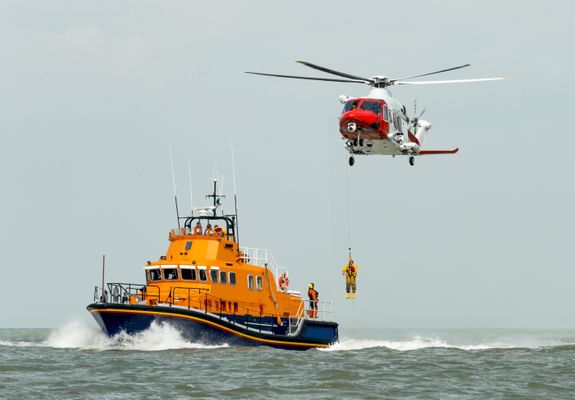
Spurn Point lifeboat & visitor's centre
- £471,000 was spent on a visitor's centre which could become less accessible over time.
- Lifeboat services also operate from Spurn Point.
1 Geography Skills
1.1 Mapping
1.1.1 Map Making
1.1.2 OS Maps
1.1.3 Grid References
1.1.4 Contour Lines
1.1.5 Symbols, Scale and Distance
1.1.6 Directions on Maps
1.1.7 Describing Routes
1.1.8 Map Projections
1.1.9 Aerial & Satellite Images
1.1.10 Using Maps to Make Decisions
1.2 Geographical Information Systems
1.2.1 Geographical Information Systems
1.2.2 How do Geographical Information Systems Work?
1.2.3 Using Geographical Information Systems
1.2.4 End of Topic Test - Geography Skills
2 Geology of the UK
2.1 The UK's Rocks
2.1.1 The UK's Main Rock Types
2.1.2 The UK's Landscape
2.1.3 Using Rocks
2.1.4 Weathering
2.2 Case Study: The Peak District
2.2.1 The Peak District
2.2.2 Limestone Landforms
2.2.3 Quarrying
3 Geography of the World
3.1 Geography of America & Europe
3.1.1 North America
3.1.2 South America
3.1.3 Europe
3.1.4 The European Union
3.1.5 The Continents
3.1.6 The Oceans
3.1.7 Longitude
3.1.8 Latitude
3.1.9 End of Topic Test - Geography of the World
4 Development
4.1 Development
4.1.1 Classifying Development
4.1.3 Evaluation of GDP
4.1.4 The Human Development Index
4.1.5 Population Structure
4.1.6 Developing Countries
4.1.7 Emerging Countries
4.1.8 Developed Countries
4.1.9 Comparing Development
4.2 Uneven Development
4.2.1 Consequences of Uneven Development
4.2.2 Physical Factors Affecting Development
4.2.3 Historic Factors Affecting Development
4.2.4 Human & Social Factors Affecting Development
4.2.5 Breaking Out of the Poverty Cycle
4.3 Case Study: Democratic Republic of Congo
4.3.1 The DRC: An Overview
4.3.2 Political & Social Factors Affecting Development
4.3.3 Environmental Factors Affecting the DRC
4.3.4 The DRC: Aid
4.3.5 The Pros & Cons of Aid in DRC
4.3.6 Top-Down vs Bottom-Up in DRC
4.3.7 The DRC: Comparison with the UK
4.3.8 The DRC: Against Malaria Foundation
4.4 Case Study: Nigeria
4.4.1 The Importance & Development of Nigeria
4.4.2 Nigeria's Relationships with the Rest of the World
4.4.3 Urban Growth in Lagos
4.4.4 Population Growth in Lagos
4.4.5 Factors influencing Nigeria's Growth
4.4.6 Nigeria: Comparison with the UK
5 Weather & Climate
5.1 Weather
5.1.1 Weather & Climate
5.1.2 Components of Weather
5.1.3 Temperature
5.1.4 Sunshine, Humidity & Air Pressure
5.1.5 Cloud Cover
5.1.6 Precipitation
5.1.7 Convectional Precipitation
5.1.8 Frontal Precipitation
5.1.9 Relief or Orographic Precipitation
5.1.10 Wind
5.1.11 Extreme Wind
5.1.12 Recording the Weather
5.1.13 Extreme Weather
5.2 Climate
5.2.1 Climate of the British Isles
5.2.2 Comparing Weather & Climate London
5.2.3 Climate of the Tropical Rainforest
5.2.4 End of Topic Test - Weather & Climate
5.3 Tropical Storms
5.3.1 Formation of Tropical Storms
5.3.2 Features of Tropical Storms
5.3.3 The Structure of Tropical Storms
5.3.4 Tropical Storms Case Study: Katrina Effects
5.3.5 Tropical Storms Case Study: Katrina Responses
6 The World of Work
6.1 Tourism
6.1.1 Landscapes
6.1.2 The Growth of Tourism
6.1.3 Benefits of Tourism
6.1.4 Economic Costs of Tourism
6.1.5 Social, Cultural & Environmental Costs of Tourism
6.1.6 Tourism Case Study: Blackpool
6.1.7 Ecotourism
6.1.8 Tourism Case Study: Kenya
7 Natural Resources
7.1.1 What are Rocks?
7.1.2 Types of Rock
7.1.4 The Rock Cycle - Weathering
7.1.5 The Rock Cycle - Erosion
7.1.6 What is Soil?
7.1.7 Soil Profiles
7.1.8 Water
7.1.9 Global Water Demand
7.2 Fossil Fuels
7.2.1 Introduction to Fossil Fuels
7.2.2 Fossil Fuels
7.2.3 The Global Energy Supply
7.2.5 What is Peak Oil?
7.2.6 End of Topic Test - Natural Resources
8.1 River Processes & Landforms
8.1.1 Overview of Rivers
8.1.2 The Bradshaw Model
8.1.3 Erosion
8.1.4 Sediment Transport
8.1.5 River Deposition
8.1.6 River Profiles: Long Profiles
8.1.7 River Profiles: Cross Profiles
8.1.8 Waterfalls & Gorges
8.1.9 Interlocking Spurs
8.1.10 Meanders
8.1.11 Floodplains
8.1.12 Levees
8.1.13 Case Study: River Tees
8.2 Rivers & Flooding
8.2.1 Flood Risk Factors
8.2.2 Flood Management: Hard Engineering
8.2.3 Flood Management: Soft Engineering
8.2.4 Flooding Case Study: Boscastle
8.2.5 Flooding Case Study: Consequences of Boscastle
8.2.6 Flooding Case Study: Responses to Boscastle
8.2.7 Flooding Case Study: Bangladesh
8.2.8 End of Topic Test - Rivers
8.2.9 Rivers Case Study: The Nile
8.2.10 Rivers Case Study: The Mississippi
9.1 Formation of Coastal Landforms
9.1.1 Weathering
9.1.2 Erosion
9.1.3 Headlands & Bays
9.1.4 Caves, Arches & Stacks
9.1.5 Wave-Cut Platforms & Cliffs
9.1.6 Waves
9.1.7 Longshore Drift
9.1.8 Coastal Deposition
9.1.9 Spits, Bars & Sand Dunes
9.2 Coast Management
9.2.1 Management Strategies for Coastal Erosion
9.2.2 Case Study: The Holderness Coast
9.2.3 Case Study: Lyme Regis
9.2.4 End of Topic Test - Coasts
10 Glaciers
10.1 Overview of Glaciers & How They Work
10.1.1 Distribution of Glaciers
10.1.2 Types of Glaciers
10.1.3 The Last Ice Age
10.1.4 Formation & Movement of Glaciers
10.1.5 Shaping of Landscapes by Glaciers
10.1.6 Glacial Landforms Created by Erosion
10.1.7 Glacial Till & Outwash Plain
10.1.8 Moraines
10.1.9 Drumlins & Erratics
10.1.10 End of Topic Tests - Glaciers
10.1.11 Tourism in Glacial Landscapes
10.1.12 Strategies for Coping with Tourists
10.1.13 Case Study - Lake District: Tourism
10.1.14 Case Study - Lake District: Management
11 Tectonics
11.1 Continental Drift & Plate Tectonics
11.1.1 The Theory of Plate Tectonics
11.1.2 The Structure of the Earth
11.1.3 Tectonic Plates
11.1.4 Plate Margins
11.2 Volcanoes
11.2.1 Volcanoes & Their Products
11.2.2 The Development of Volcanoes
11.2.3 Living Near Volcanoes
11.3 Earthquakes
11.3.1 Overview of Earthquakes
11.3.2 Consequences of Earthquakes
11.3.3 Case Study: Christchurch, New Zealand Earthquake
11.4 Tsunamis
11.4.1 Formation of Tsunamis
11.4.2 Case Study: Japan 2010 Tsunami
11.5 Managing the Risk of Volcanoes & Earthquakes
11.5.1 Coping With Earthquakes & Volcanoes
11.5.2 End of Topic Test - Tectonics
12 Climate Change
12.1 The Causes & Consequences of Climate Change
12.1.1 Evidence for Climate Change
12.1.2 Natural Causes of Climate Change
12.1.3 Human Causes of Climate Change
12.1.4 The Greenhouse Effect
12.1.5 Effects of Climate Change on the Environment
12.1.6 Effects of Climate Change on People
12.1.7 Climate Change Predictions
12.1.8 Uncertainty About Future Climate Change
12.1.9 Mitigating Against Climate Change
12.1.10 Adapting to Climate Change
12.1.11 Case Study: Bangladesh
13 Global Population & Inequality
13.1 Global Populations
13.1.1 World Population
13.1.2 Population Structure
13.1.3 Ageing Populations
13.1.4 Youthful Populations
13.1.5 Population Control
13.1.6 Mexico to USA Migration
13.1.7 End of Topic Test - Development & Population
14 Urbanisation
14.1 Urbanisation
14.1.1 Rural Characterisitcs
14.1.2 Urban Characteristics
14.1.3 Urbanisation Growth
14.1.4 The Land Use Model
14.1.5 Rural-Urban Pull Factors
14.1.6 Rural-Urban Push Factors
14.1.7 The Impacts of Migration
14.1.8 Challenges of Urban Areas in Developed Countries
14.1.9 Challenges of Urban Areas in Developing Countries
14.1.10 Urban Sustainability
14.1.11 Case Study: China's Urbanisation
14.1.12 Major UK Cities
14.1.13 Urbanisation in the UK
14.1.14 End of Topic Test- Urbanisation
14.1.15 End of Topic Test - Urban Issues
15 Ecosystems
15.1 The Major Biomes
15.1.1 Distribution of Major Biomes
15.1.2 What Affects the Distribution of Biomes?
15.1.3 Biome Features: Tropical Forests
15.1.4 Biome Features: Temperate Forests
15.1.5 Biome Features: Tundra
15.1.6 Biome Features: Deserts
15.1.7 Biome Features: Tropical Grasslands
15.1.8 Biome Features: Temperate Grasslands
15.2 Case Study: The Amazon Rainforest
15.2.1 Interdependence of Rainforest Ecosystems
15.2.2 Nutrient Cycling in Tropical Rainforests
15.2.3 Deforestation in the Amazon
15.2.4 Impacts of Deforestation in the Amazon
15.2.5 Protecting the Amazon
15.2.6 Adaptations of Plants to Rainforests
15.2.7 Adaptations of Animals to Rainforests
16 Life in an Emerging Country
16.1 Case Studies
16.1.1 Mumbai: Opportunities
16.1.2 Mumbai: Challenges
17 Analysis of Africa
17.1 Africa
17.1.1 Desert Biomes in Africa
17.1.2 The Semi-Desert Biome
17.1.3 The Savanna Biome
17.1.4 Overview of Tropical Rainforests
17.1.5 Colonisation History
17.1.6 Population Distribution in Africa
17.1.7 Economic Resources in Africa
17.1.8 Urbanisation in Africa
17.1.9 Africa's Location
17.1.10 Physical Geography of Africa
17.1.11 Desertification in Africa
17.1.12 Reducing the Risk of Desertification
17.1.13 Case Study: The Sahara Desert - Opportunities
17.1.14 Case Study: The Sahara Desert - Development
18 Analysis of India
18.1 India - Physical Geography
18.1.1 Geographical Location of India
18.1.2 Physical Geography of India
18.1.3 India's Climate
18.1.4 Natural Disasters in India
18.1.5 Case Study: The Thar Desert
18.1.6 Case Study: The Thar Desert - Challenges
18.2 India - Human Geography
18.2.1 Population Distribution in India
18.2.2 Urabinsation in India
18.2.3 The History of India
18.2.4 Economic Resources in India
19 Analysis of the Middle East
19.1 The Middle East
19.1.1 Physical Geography of the Middle East
19.1.2 Human Geography of the Middle East
19.1.3 Climate Zones in the Middle East
19.1.4 Climate Comparison with the UK
19.1.5 Oil & Natural Gas in the Middle East
19.1.6 Water in the Middle East
19.1.7 Population of the Middle East
19.1.8 Development Case Studies: The UAE
19.1.9 Development Case Studies: Yemen
19.1.10 Supporting Development in Yemen
19.1.11 Connection to the UK
19.1.12 Importance of Oil
19.1.13 Oil & Tourism in the UAE
20 Analysis of Bangladesh
20.1 Bangladesh Physical Geography
20.1.1 Location of Bangladesh
20.1.2 Climate of Bangladesh
20.1.3 Rivers in Bangladesh
20.1.4 Flooding in Bangladesh
20.2 Bangladesh Human Geography
20.2.1 Population Structure in Bangladesh
20.2.2 Urbanisation in Bangladesh
20.2.3 Bangladesh's Economy
20.2.4 Energy & Sustainability in Bangladesh
21 Analysis of Russia
21.1 Russia's Physical Geography
21.1.1 Russia's Climate
21.1.2 Russia's Landscape
21.2 Russia's Human Geography
21.2.1 Population of Russia
21.2.2 Russia's Economy
21.2.3 Energy & Sustainability in Russia
Jump to other topics

Unlock your full potential with GoStudent tutoring
Affordable 1:1 tutoring from the comfort of your home
Tutors are matched to your specific learning needs
30+ school subjects covered
Management Strategies for Coastal Erosion
Case Study: Lyme Regis

IMAGES
VIDEO
COMMENTS
Mappleton is an excellent case study of an attempt at coastal management, which has a negative impact further along the coast. Spurn Point provides evidence of longshore drift on the Holderness Coast. It is an excellent example of a spit, a depositional landform. Around 3% of the material eroded from the Holderness Coast is deposited here annually.
The coastline is rapidly eroding at an average of 1.8 metres a year. There are several reasons why the coast at Holderness is eroding so quickly: Bridlington is protected by a 4.7 km long sea wall ...
Arange of classic coastal features stretch over 50km, from the chalk cliffs of Flamborough, through the plain of Holderness, to Spurn Head where a large spit guards the entrance to the Humber estuary. The combination of clay geology and a high-energy environment has helped make this part of the Yorkshire coast one of the most rapidly eroding ...
The Holderness Coast is one of Europe's fastest eroding coastlines. The average annual rate of erosion is around 2 metres per year. The main reason for this is because the bedrock is made up of till (soft clay). This material was deposited by glaciers around 12,000 years ago. The coastline stretches along the coast of the East Riding of ...
Where is the Holderness Coast? What defences are found along the coastline? What is the coastal management at Mappleton? This is the forty-second video for t...
Spurn Point lifeboat & visitor's centre. £471,000 was spent on a visitor's centre which could become less accessible over time. Lifeboat services also operate from Spurn Point. The Holderness coast is located next to the city of Hull in the north-east of England. Each year, the Holderness Coast retreats 1-2 metres.
The Holderness Coastline. The Holderness Coastline. Coastal Management Case Study ...
The Holderness coast is located next to the city of Hull in the north-east of England. Each year, the Holderness Coast retreats 1-2 metres. The area is particularly vulnerable to erosion because of:
The Holderness Coastline is the fastest eroding coast in the UK with in a single storm hundreds of thousands of tonnes of rock being eroded. There are three main reasons why this is the case, these are: 1. Geology - boulder clay and glacial sands make up a large amount of the coast ... Case Study - Crowded Coasts - Edexcel Geography IAL
Holderness Coastline Geology Defending the coast Find out more. The Holderness Coastline is in the North of England and runs between the Humber Estuary in the south and a headland at Flamborough head. It has the unenviable reputation as the number one place in Europe for coastal erosion, and in a stormy year waves from the North sea can remove ...
Spurn is key in protecting a deep water channel into the Humber Estuary, which is essential for the 20% of UK shipping imports through Humber Ports. Study with Quizlet and memorize flashcards containing terms like Where is the Holderness Coast?, How far has the coast retreated?, What does the Holderness Coast SMP aim to protect? and more.
Massive, made of rocks or Traditional solution to protect Very costly, foundations easily Holiday resorts, e.g. Hornsea and concrete, used to absorb waves. valuable resources, high-risk undermined of built on beaches, or Withernsea Some types can act as Baffles property or densely populated where LSD operates areas.
Delve into the fastest eroding coastline in Europe
breaking up into a chain of islands. Study with Quizlet and memorize flashcards containing terms like where is the Holderness coast?, what three factors make up the 'worst combination of factors' for the Holderness coast?, what are subaerial processes? - (such as freeze/thaw and salt crystalisation) and more.
Defending the Holderness Coastline There is a debate about whether or not human beings should attempt to defend coastlines. In the case of the Holderness coastline, its geology (weak clays) waves (destructive during North Sea storms) and Geomorphology (the shape of the coastline allows the waves to break at the base of the cliffs) make erosion ...
What are the names of coastal features along the Holderness Coast? - Headlands (Flamborough Head) - Wave cut platforms / notches (Flamborough Head) - Spit (Spurn Point, where 3% of the material eroded from the Holderness Coast is deposited annually. Sand dunes are formed, which stabalize it) - Bays (Selwicks Bay has Adam the stack, a wavecut ...
There was £2.9 million of damage a year before the management was put in place. It produced a sandy beach and alos protects the town, a Grade 2 listed church and the B1242. Strategies: Rock Armour at a cost of £2 million. BUT: South of Mappleton, the rate of erosion has increased significantly. Easington.
A level Geography: Coasts case study, The Holderness coast. Get a hint. Introduction. Click the card to flip 👆. - the coast is 60km long. - The Holderness coastline is in the North of England and runs between spurn head and Flamborough head. - Approximately, 3 miles of land has been lost since Roman times, including 23 towns/ villages.
In Skipsea on the Holderness coastal erosion rates since 1989 have been 1.4m per year on average; ... 1.3.2 Multiple-Hazard Zone Case Study; 1.3.3 Theoretical Frameworks; 1.3.4 Mitigation & Adaptation ... Technology and Education from the University of Nottingham focussing on online learning. At a time when the study of geography has never been ...